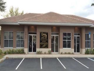
2103 & 2125 17th Street E, Palmetto, FL 34221
sale
$2,800,000
|
Other
Courtesy Of White Sands Realty Group Florida
Exceptional opportunity to acquire the 17TH Street Industrial Assemblage, consisting of two contiguous industrial parcels totaling approximately 4.78 acres in Palmetto, Florida. The assemblage offers a unique combination of current cash flow, industrial utility, and long-term redevelopment potential. Existing revenue is generated through outdoor storage operations and a telecommunications tower lease, creating immediate income while preserving future flexibility. Improvements include an industrial building, existing concrete slab, fenced storage yard, and a 5,000-square-foot building package included with the sale. Ideal for Industrial Outdoor Storage (IOS), contractor yard operations, fleet parking, equipment storage, owner-users, investors, or future industrial redevelopment. Conveniently located near Port Manatee, US-41, US-301, and Interstate 75 within one of Manatee County's most active industrial growth corridors. Offered together as a 4.78-acre assemblage for maximum value and operational flexibility.
Read More About This Property
Read Less About This Property
Copyright © 2026 Stellar MLS. All rights reserved. All information provided by the listing agent/broker is deemed reliable but is not guaranteed and should be independently verified. Information being provided is for consumers' personal, non-commercial use and may not be used for any purpose other than to identify prospective properties consumers may be interested in purchasing.
Property Features
- Age: 41-50 Years Old
- Legal Description: COM AT NW COR OF E1/2 OF W1/2 OF NE1/4 OF NW1/4 OF SEC 18-34-18; TH RUN S 0 DEG 21 MIN 30 SEC W ALG W LN OF E1/2 OF W1/2 OF NE1/4 OF NW1/4, 315.43 FT; TH RUN S 89 DEG 23 MIN 30 SEC E, 30 FT FOR A POB; TH RUN S 89 DEG 23 MIN 30 SEC E, 299.7 FT; TH RUN N 294.16 FT; TH RUN N 89 DEG 30 MIN 30 SEC W, 299. 7 FT; TH RUN S 290.43 FT TO POB AS DESC IN OR 1150 P 1576 PI#10005.1005/5 and COM AT THE NW COR OF E1/2 OF W1/2 OF NE1/4 OF NW1/4; TH RUN S 0 DEG 21 MIN 30 SEC W ALG W LN OF SD E1/2 OF W1/2 OF NE1/4 OF NW1/4, 315.43 FT, TH RUN S 89 DEG 23 MIN 30 SEC E 30 FT FOR POB; TH RUN S 89 DEG 23 MIN 30 SEC E 299.7 FT; TH RUN S 0 DEG 23 MIN 30 SEC W ALG E LN OF SD E1/2 OF W1/2 OF NE1/4 OF NW1/4 402.2 FT, TH RUN N 89 DEG 30 MIN 20 SEC W 299.55 FT; TH RUN N 0 DEG 21 MIN 30 SEC E A DIST OF 402.8 FT TO POB TOGETHER WITH AN EASEMENT FOR INGRESS & EGRESS OVER THE N 718.23 FT OF THE W 30 FT OF THE SD E1/2 OF W1/2 OF NE1/4 OF NW1/4 AS DESC IN ORB 685 P 571 PI#10005.1000/6
- MLSID: A4699695
Data powered by Attom Data Solutions. Copyright© 2026. Information deemed reliable but not guaranteed.